Paysage is the French word for “landscape.” But paysage often carries a broader meaning than the English word landscape typically does, as it can also describe a cultural or historic landscape, that is, a place shaped over millennia by the interaction of natural features and human activity.
For part of our trip we traveled along the “Alsace Wine Route,” a paysage shaped by plentiful small vineyards, nestled in valleys often running along the foothills of the Vosges Mountains, linking a chain of compact, centuries-old villages.
One thing I’ve learned since returning home is that in France governments at all levels—local, regional, and national—recognize that the paysage itself is a major economic asset and have developed a complex web of land use and farmland preservation policies (which I’ll make note of later) designed to protect and foster this asset.
Foremost in Alsace, of course, is a strong interest in maintaining a thriving and profitable wine-growing sector. But not far behind appears to be an appreciation for tourists from around the world who specifically set out to visit and explore this scenic and historic part of France.
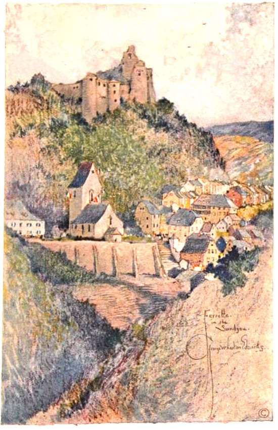
I came across a fascinating travel journal by artist / writer George Wharton Hamilton, Alsace-Lorraine. Written in 1924, Hamilton explores life in this region still recovering from World War I. The book includes many beautiful illustrations by Hamilton (such as the one shown here). You can probably find a used copy online. To give you a flavor for his book, here’s a short excerpt about the landscape of castle ruins:
“The wooded heights grow into mountains all crested with ancient gray ruin of historic strongholds. . . . Cannon and powder brought the doom of the great strongholds so long deemed impregnable. The massive towers fell like ninepins under the blast, and many vanished into dust, leaving hardly a trace to mark the site now so exquisitely draped in ivy. Thus the whole region became what the tourist calls ‘picturesque.’“
.jpg)
Paysage et château du Wineck à Katzenthal (Haut-Rhin, France). Photo by Gzen92.
Creative Commons Attribution-Share
Alike 4.0 International license.
Among the factors making up this wine country paysage are: small, well-preserved villages often centered on historic churches and municipal buildings (hôtel de ville). These villages are set close by vineyards or farmland. From what I saw, and later read, there is much less evidence of sprawling development cutting up this kind of productive land than you’d see in the United States.
Unique to the Alsatian paysage are the numerous centuries-old castle ruins—along with a few restored castles, such as the Château du Kœnigsbourg—that are set across the Vosges Mountains, overlooking villages and vineyards below.
One element that helps minimize sprawl is the presence of a well-used and -maintained passenger rail network. This network is actually one of the most important, though sometimes overlooked, reasons Alsace’s wine country paysage remains intact. Good rail service reduces the need for using one’s car and makes infill housing in towns and cities more attractive, in turn reducing sprawling development.
Fortunately Alsace has a favorable geography for rail, with a long north-south corridor with the Vosges Mountains on one side and the Rhine Valley on the other. Towns line up naturally along this corridor, making rail service efficient. In France, as in most of Europe, government policies promote rail service. Yes, there are highways in France, including in Alsace. But in France the balance between road and rail tilts more toward rail than it does in the United States.
Traveling through several of the small towns along the wine route, we could get a feel for their compact development pattern.
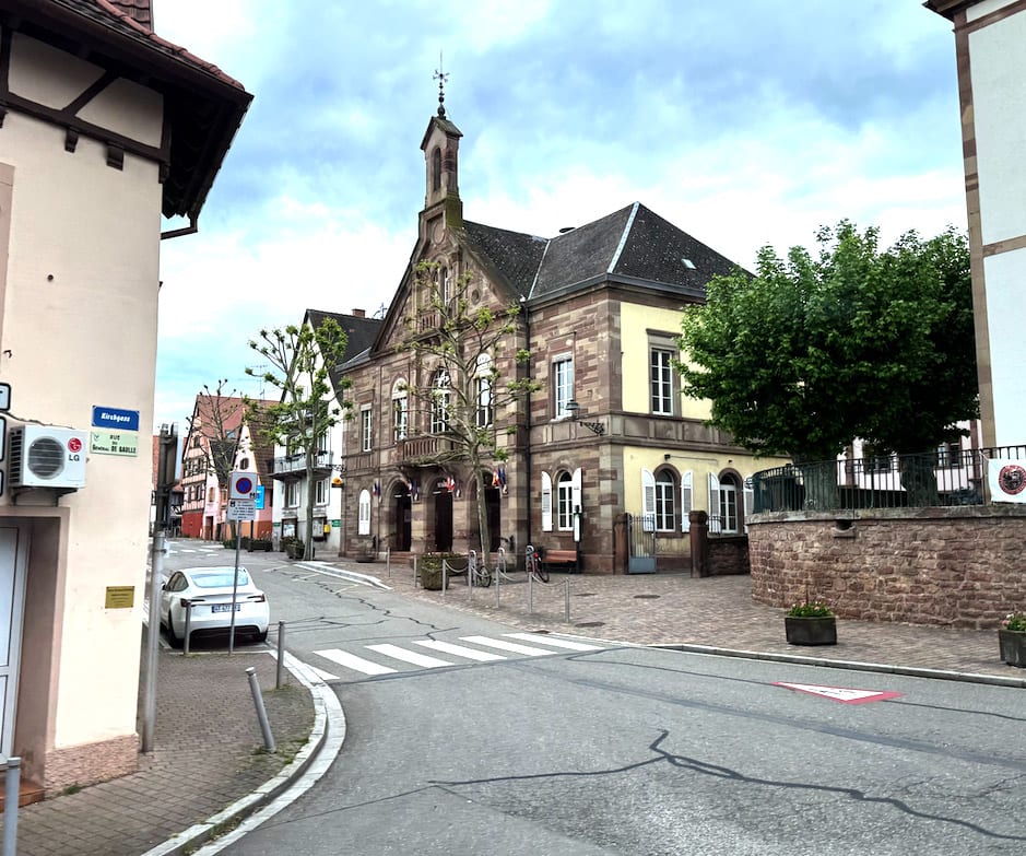
Above and right: Rounding a corner in the center of the village of Kintzheim,
by the intersection of Rue de la Liberté and Rue du Général De Gaulle. The beautiful
brown
sandstone Hôtel de Ville with its tower is on the right side of the street.
Use link for close-up view.
.jpg) Continuing
down the street in Kintzheim: a variety of building styles, but everything seems to fit.
Use
Google Street view
to walk around the center of town.
Continuing
down the street in Kintzheim: a variety of building styles, but everything seems to fit.
Use
Google Street view
to walk around the center of town.
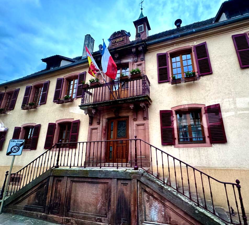
Hôtel de Ville (City Hall) in the village of Saint-Hippolyte.
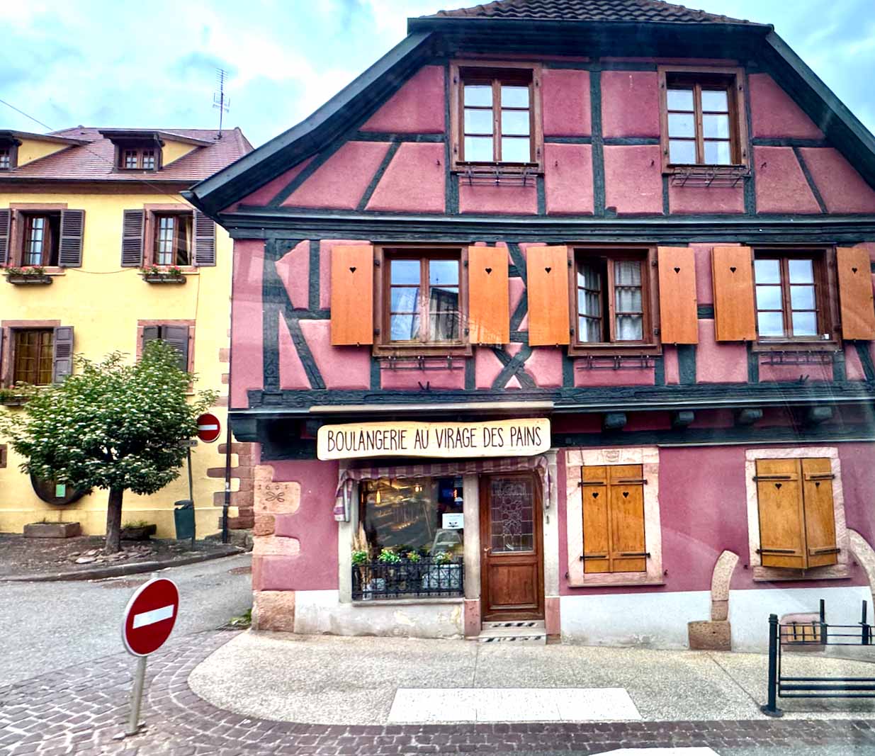 City
Hall in Saint-Hippolyte is next door to the boulangerie. A good combination to have in the center of town! Plus nice road pavers.
City
Hall in Saint-Hippolyte is next door to the boulangerie. A good combination to have in the center of town! Plus nice road pavers.
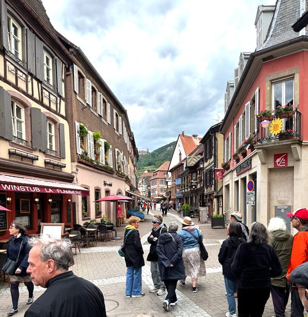
Our lunch stop was in the more tourist-oriented, but also attractive, town of Ribeauvillé.
It’s a town that has a love for storks.
We spotted a pair lodging on a rooftop. Storks have apparently nested in Alsatian villages for generations, and towns often install and
maintain nesting platforms. They are viewed as symbols of good fortune, family, and regional identity.
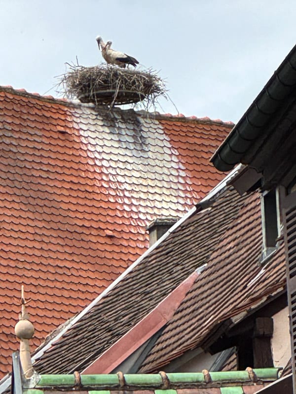 Above:
Apparently a popular nesting spot for storks.
Above:
Apparently a popular nesting spot for storks.
Below: Our group heads down Ribeauvillé’s main street.
.jpg) I
had to give this photo plenty of space so you can read this Test de Vue Alsacien (eye chart). Suffice it to say it focuses on wines, ending
with S’gilt, the Alsatian word for “Cheers.” I guess if you start drinking when looking at the top of the chart you’ll need the giant size
letters by the time you get to S’gilt!
I
had to give this photo plenty of space so you can read this Test de Vue Alsacien (eye chart). Suffice it to say it focuses on wines, ending
with S’gilt, the Alsatian word for “Cheers.” I guess if you start drinking when looking at the top of the chart you’ll need the giant size
letters by the time you get to S’gilt!
Another factor that I think helps preserve the paysage in this wine-growing part of Alsace is the multigenerational familial links
to the land. Also important are land use policies designed to promote the preservation of small-scale, family-owned farms and vineyards.
That’s where a French program called SAFER comes into play.
SAFER stands for Société d’Aménagement Foncier et d’Établissement Rural. In English that would be Land Development and Rural Settlement
Corporation
In some circumstances, the sale of agricultural land to a large enterprise can be blocked if there is a young farmer (or vintner) who is
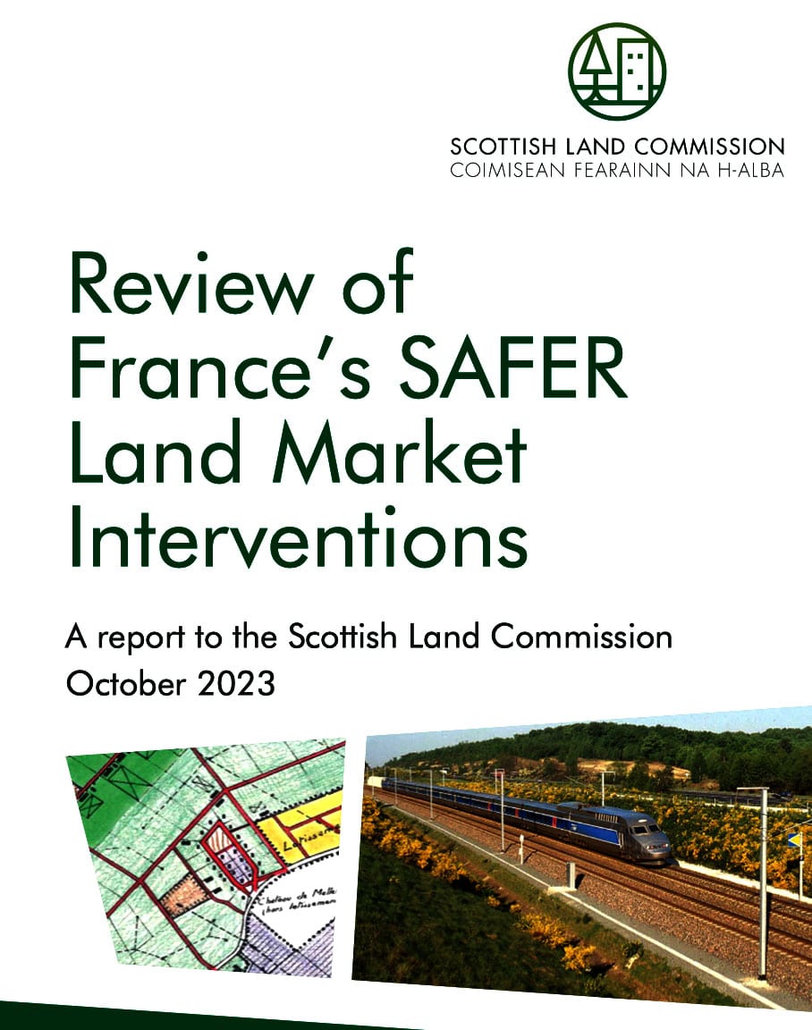
willing to purchase the parcel, albeit at a lower price. See “Review of France’s SAFER” (pp. 23-24), cited at the bottom of the sidebar.
There are mechanisms for compensating the seller when this occurs.
A well-researched Scottish report on how France’s SAFER program works notes that “the SAFER was created . . . as part of extensive
agricultural reforms rolled into the Orientation Laws of 1960. The legislation established that each region in France should have a ‘SAFER’
office which would monitor regional sales of farmland, and which would have the power to intervene in land sales.
“The SAFER can be considered equivalent to a land bank purchasing and storing lands before redistributing them to individual buyers in a bid
to consolidate land parcels and render French agriculture more effective. . . .
“Originally the SAFERs intervened only in the service of the agricultural sector, for example to assist young farmers acquire land, increase the size of holdings, or to restructure land parcels. . . .
“More recently the mission of the SAFERs has been enlarged to include environmental protection of the countryside. . . .
“To fulfil their public missions the SAFERs purchase and sell rural and agricultural property on the open market. They may use a pre-emptive
right to intervene in land sales, as notaries have an obligation to inform the SAFERs of any sales they are handling two months prior to the
closing of the sale” (p. 7).
K. Shields, “Review of France’s SAFER Land Market Interventions,” Scottish Land Commission, 2023.
As the Scottish report on SAFER notes: “The introduction of SAFER was intended to preserve French agriculture and enable young farmers to
access land and the consensus amongst the expert interviews was that SAFER has achieved this aim” (p. 30).
A hallmark of farmland preservation efforts is the often quite visible demarcation between farmland and development.
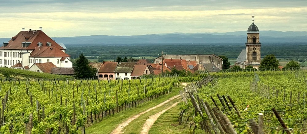
Vineyards surround the small village of Saint-Hippolyte, located at the foot of the Vosges Mountains, on the Alsace Wine Route.
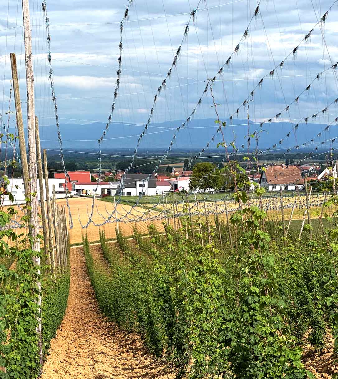
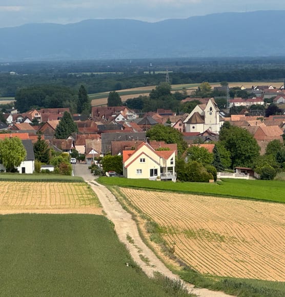
Although France generally does not employ American-style urban growth boundaries, its integrated system of land use planning, agricultural protection, and regional coordination results in compact towns surrounded by working farmland or vineyards.
In the United States, this demarcation is most visible in Oregon as a result of that state’s urban growth boundary policies, but also found in Lexington, Kentucky, where horse country is protected from development. See the short video accompanying the post “The Wonky Magic of Urban Growth Boundaries.” For an overview of urban growth boundaries, take a look at this article I wrote back in 2013.
I can’t end this post without showing how at least one more artist has depicted the Alsatian paysage—in this case, the village of
Waldersbach.
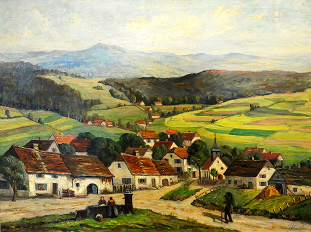
Juliette Kromer Kessler, Waldersbach in Alsace-Lorraine (oil on canvas, 1945),
from “Paintings of Oberlin’s region in Alsace," Oberlin College Archives.
Waldersbach is a very small mountain village, about 45 km southwest of Strasbourg. Take a look at two of Juliette Kessler’s other paintings of this part of Alsace; and here’s a 2016 Google street view of the center of Waldersbach.
Waldersbach is linked to Ohio’s Oberlin College and the town of Oberlin.
As the college notes: “The town of Oberlin, Ohio and its college were founded in 1833 and named in honor of John Frederick (Jean-Frédéric) Oberlin, a French Lutheran pastor from Strasbourg who served in a remote region called the Ban de la Roche in Alsace, France until his death in 1826. . . . Oberlin’s founders in Ohio, having read a biography of Oberlin published in America in 1830, were inspired to create a new community and institution of higher learning, in what was then a wilderness, for scholars and students who wished to be of service to others and change the world for the better, as J. F. Oberlin had done in Alsace. . . . .
“Today’s Oberlin College and community are the inheritors of J. F. Oberlin’s belief that an enlightened education is the crucible for social change, a sustainable way of life, and a truly democratic society based on equality and self-sufficiency.”
One more Oberlin link: Lila and I had our wedding party at Oberlin College in 1976!
And with that, you’ve reached the end of “Learning from Alsace-Lorraine.”
All photos by the author unless otherwise indicated.
This is the final post in the Learning from Alsace-Lorraine series.
To see a list of all the posts in the Learning from Alsace-Lorraine series, click here.
© 2026 Wayne Senville. Text, photographs, and original graphics, except where otherwise credited. Published by the Alliance Française of the Lake Champlain Region with permission of the author.
Leave a Comment